Contact Info
+98 21 2691 9361+98 21 2691 9439
Email: info@pvada.co
Address
Burjuman Office Tower, Level 15,
Mankhool, Dubai, United Arab Emirates
Contact Info
+98 21 2691 9361+98 21 2691 9439
Email: info@pvada.co
Address
Burjuman Office Tower, Level 15,
Mankhool, Dubai, United Arab Emirates
Contact Info
+98 21 2691 9361+98 21 2691 9439
Email: info@pvada.co
Address
Burjuman Office Tower, Level 15,
Mankhool, Dubai, United Arab Emirates
We understand the expectations of our customers very well. All we require is a Point Cloud Scan Laser Survey data and Company Standards ‐ template, drafting guidelines from our customers for us to deliver the BIM model with the required Revit Version: 2018/2019/2020/2021 and 2D as-built drawings with dimensions, annotations, and layering, etc.
We provide data in four Levels of Documentation depending upon the requirement— Level 1 (Floor Plans), Level 2 (Exterior Elevation and roof Plans), Level 3 (Sections), and Level 4 (Site Layout Plans).
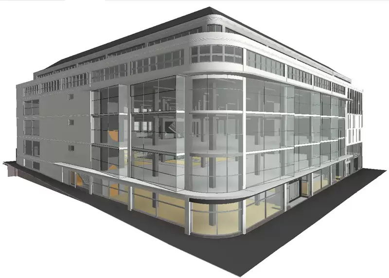
Our Scan to BIM modeling team has experience in creating an information-rich as-built 3D BIM model or 2D drawings for customers for design validation/planning/comparison, interference checks, MEP or construction elements demolition, or addition, documentation of existing building conditions, quantity take-off, and budget estimation.
We provide our Scan to BIM services (aka Point Cloud Modeling services) to Laser Scanning Companies, Surveyors, Property Owners, Architectural Design Firms, MEP Engineering Companies, and General Contractors or Construction Management companies. Our experience includes developing parametric 3D BIM and 2D CAD models capturing architectural, structural, and MEP elements for hotel, educational, and commercial projects.
Our Scan to BIM services include the following types of modeling:
Point Cloud to BIM
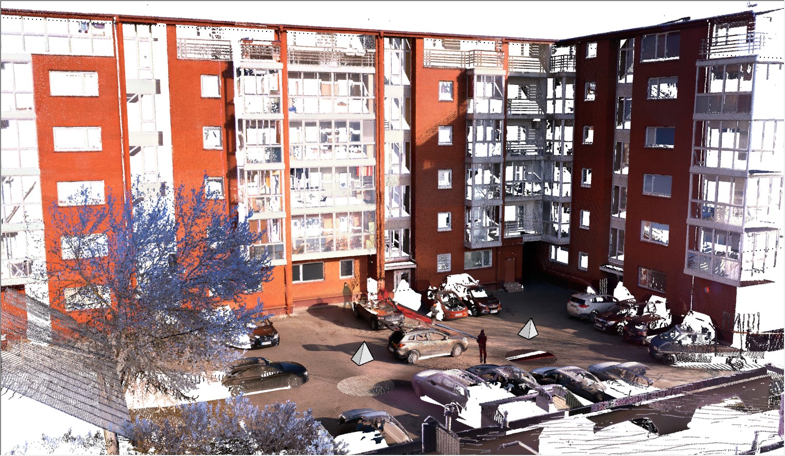
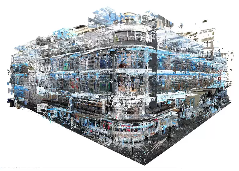
We understand what a well-executed plan takes for any Retrofit/Refurbishment, Reconstruction, and Renovation Project. All the data-driven decisions like planning, estimation, feasibility analysis, etc. depending on the accuracy of the as-built model which is created from a Point Cloud Scan. A point cloud is a set of points that accurately represents the building surfaces which are used to create a 3D BIM model or/and a 2D as-built drawing. We can work on both lasers surveyed data images and point cloud data. Our Scan to BIM services (Point Cloud Modeling services) also applies for Infrastructure projects like tunnels, bridges, roads, etc.
We provide the following Level of Documentation for our clients:
We have experience of developing both Revit (.rvt) and CAD (.dwg) files from different formats of scans or point cloud data usually captured by commonly used laser scan machines— Leica Geosystems, Trimble, Faro Scanners, Reigl scanners. We also convert other format data (i.e. .fls, .e57, .pcg. .obj, .ptg) into Revit-ready format. We create information-rich BIM Ready 3D Model for Architectural, Structural and MEPFP Requirement, and Clash-free integration.
Adding {{itemName}} to cart
Added {{itemName}} to cart